Paddled to Lundy, again. I’ve written about this lovely granite isle before, here and here. However, Lundy isn’t just granite. One small area around landing beach and Rat Island contains the ‘country rock’. This was the existing rock that the granite magma forced its way into. You can see the Morte Slates Formation when you land on the island and head up the track (to the pub!). The point where the granite and the slate meet is called the ‘contact’. You’ll have to take my word for it, as I don’t have any pictures. Guess that’s an excuse to go back…

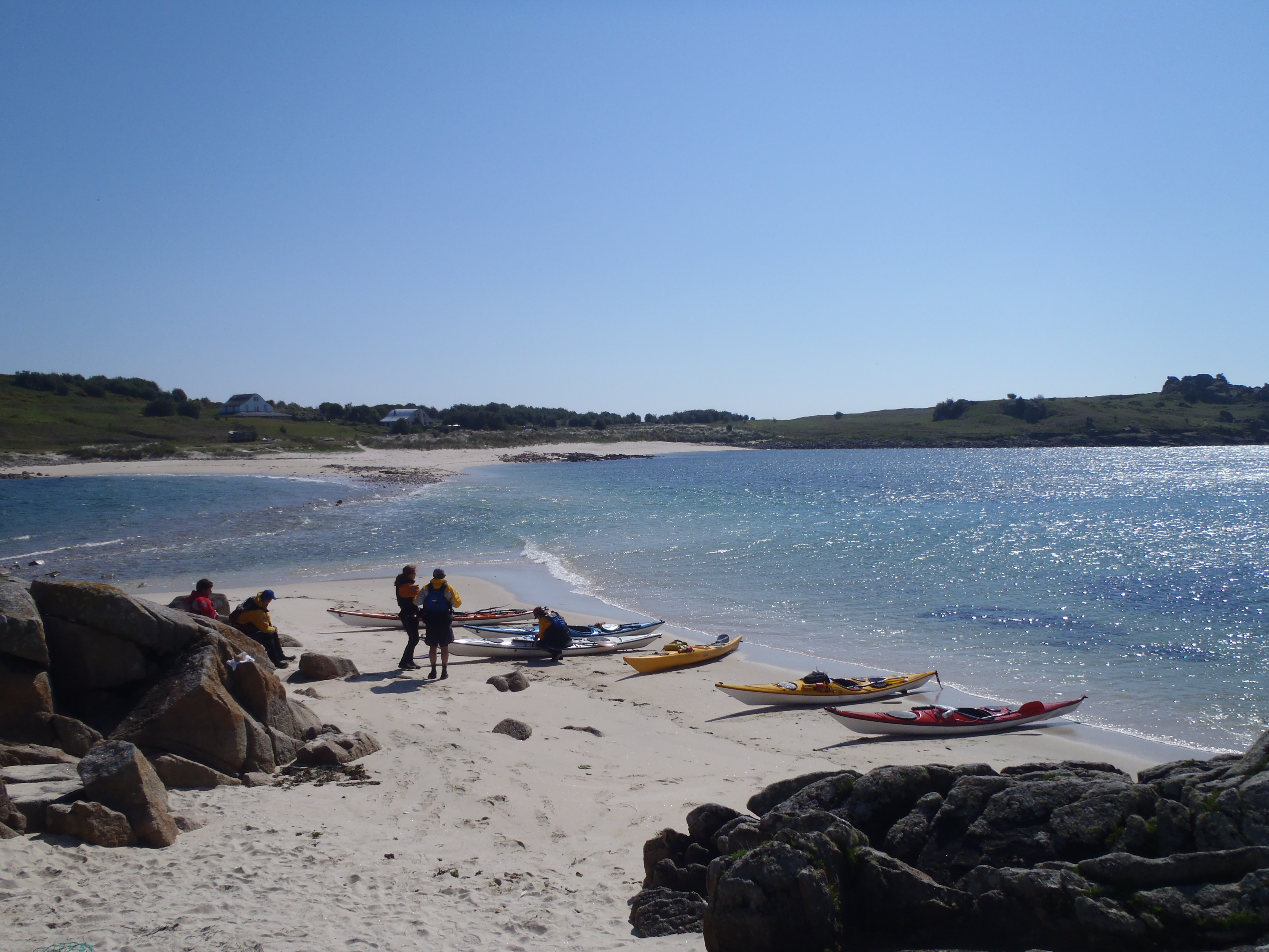
Rat Island and the landing beach, a corner of Morte Slates on a granite isle
Five paddled from Lee Bay, one fine Friday evening. Beautiful summer conditions and the novel experience of a divorce boat (read double kayak). I’d actually recommend doing long crossings in a double (assuming you get on with your par’ner), as it’s delightfully sociable and I felt so rested that I could have turned around and paddled straight back! Our bearing was slightly off so we arrived at the north end of the Island, not that it mattered particularly because the advance party had thoughtfully ordered food for us in the Marisco Tavern; we were on the brink of being too late for dinner!
Saturday saw us paddling clockwise around the island with the others. Towering tors, lazing seals, challenging lunch spots and an exciting bouncy journey down the eastside. The circumnavigation of Lundy is still one of my favourites. Indeed, a double kayak allows for time to be photographer; I certainly enjoyed the free ride at the front! I also discovered that the front person doubles as a breakwater – this was somewhat less pleasant.
Whilst we paddled down the east side of the island I picked up the maritime forecast: force 5 easterlies were expected. Well, that extinguished any hope we’d be paddling back to the mainland. The Oldenburg has rather idiosyncratic sailing dates, not ideal for stranded sea kayakers. We would have been stuck until the next sailing, on Tuesday. However, a bit of grovelling secured places for us on the charter boat that the rest of the group were using.
Sunday was as windy as forecast, but this gave me exploration time, something that I missed on my previous visit. And the journey back on the Obsession II was an adventure in itself: a cross between a bucking bronco and a log-flume. A wild ride home! We were quite literally thrown off the boat at Lee Bay so that we could collect our cars. I suppose that’s the service you can expect from hitchhiking.
Did you know that ‘lundi’ is the Icelandic word for puffin? The Norse origin of the word gives reason for the island’s name. The eradication of rats on Lundy seems to be a ray of hope for the island’s puffin population. However, it might be too little too late as rising sea temperatures are causing the northward shift in seabirds’ food, for example the sandeel. It is seems possible that puffins will leave Lundy as they move north in search of food.

West coast of Lundy

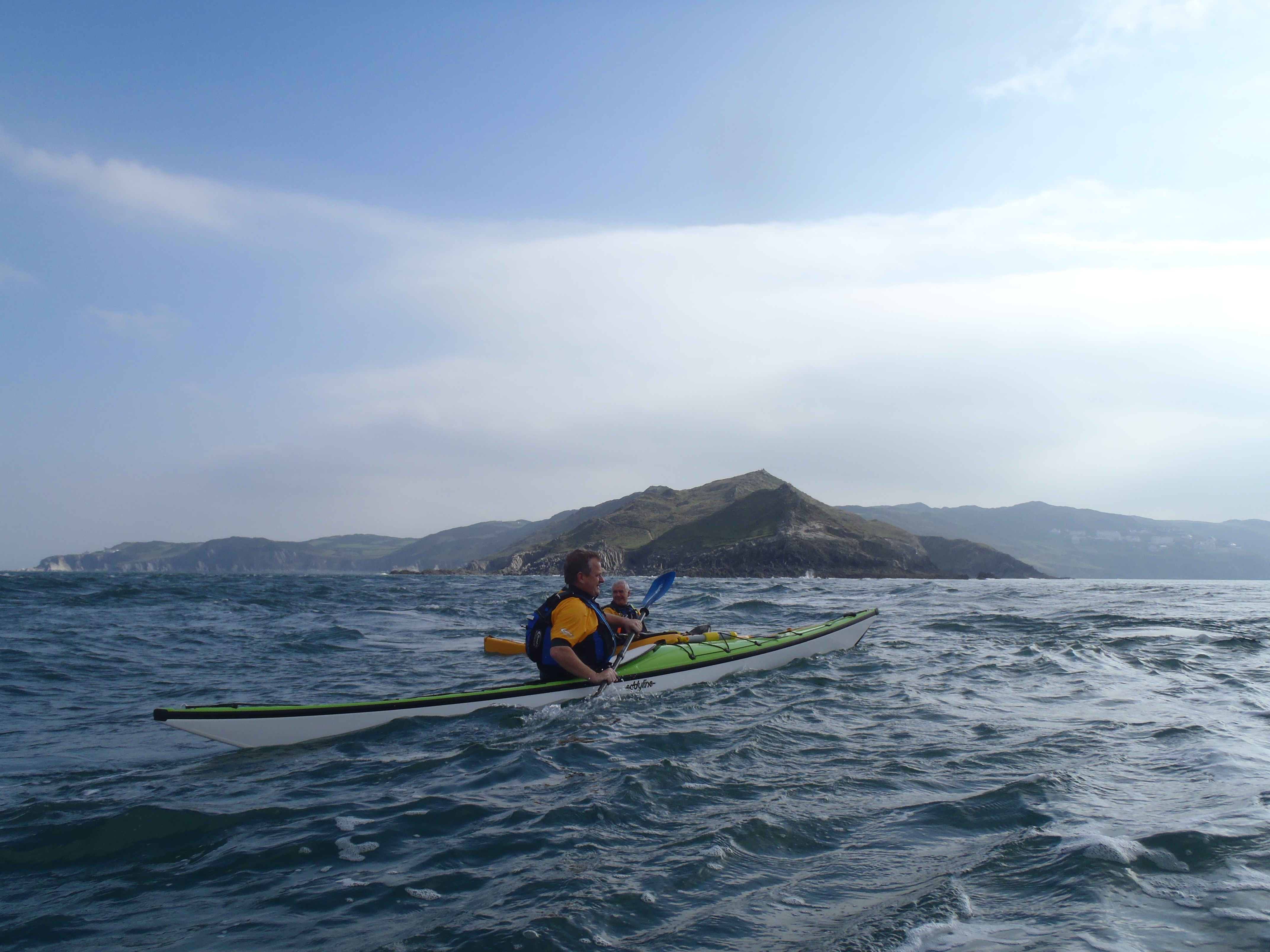
The crossing

Ooops, wrong end!

Nearly there!

Squeezing between Rat Island

Granite on a grand scale

Lounging around

Many caves for exploring

Challenging luncheon

Spectacular west coast

Bouncy ride round the north side

Can you spot the 2nd kayak?

Disused lighthouse


![944477_10151504897492800_1661521284_n[1]](https://kayakingontherocks.files.wordpress.com/2013/10/944477_10151504897492800_1661521284_n1.jpg)


")


